As an office full of hiking fanatics, we all agree that Switzerland is a must for those looking to reach new heights. With so many valleys and mountain peaks to find, choosing which trail to take can be overwhelming, so we have compiled a list of off-the-beaten-path trails in diverse settings. With the help of one of our local guides, these hikes are sure to provide you with a unique and unforgettable experience. Long walks are good for conversations and work as a great digestif. The best way to get the most out of your change of scenery, is by leaving the tracking gadgets behind and sharing a friendly greeting with fellow hikers along the way.
We fully agree with Trinity College professor Shane O’Mara’s observation of the remarkable benefits of walking: “Walking improves our moods, our clarity of thought, our creativity, as well as our humanity and connectedness to our social and natural worlds. Walk we must and walk we should!”
Lauterbrunnen to Mürren via Grütschalp, Interlaken
Duration: 5.5 hours
Distance: 10.5 miles
Begin your hike in the picturesque valley of Lauterbrunnen. Hike up to Grütschalp and enjoy panoramic views of the valley below. Continue hiking to Mürren, a charming, car-free village perched on a cliff overlooking the valley. Explore Mürren and its surrounding trails before returning to Lauterbrunnen by cable car or hiking trail.
Panorama Trail: Wengen to Kleine Scheidegg via Mannlichen
Duration: 2.5 hours
Distance: 5.9 miles
Start your hike in the idyllic village of Wengen. Hike up to Mannlichen, offering a stunning view of the Lauterbrunnen Valley and the surrounding peaks. Continue your hike to Kleine Scheidegg, passing through alpine meadows and rocky terrain. Enjoy lunch at a mountain hut or restaurant before descending the peak back to Wengen. You may also opt to take a train to the starting point.
Schynige Platte Panorama Trail
Duration: 2.5 hours
Distance: 3.7 miles
Take the nostalgic cogwheel train from Wilderswil to Schynige Platte. Embark on the Schynige Platte Panorama Trail, a loop trail with panoramic views of the Jungfrau region. Hike through alpine meadows adorned with wildflowers and enjoy views of the Eiger, Mönch, and Jungfrau mountains. Return to Schynige Platte and descend back to Wilderswil by cogwheel train.
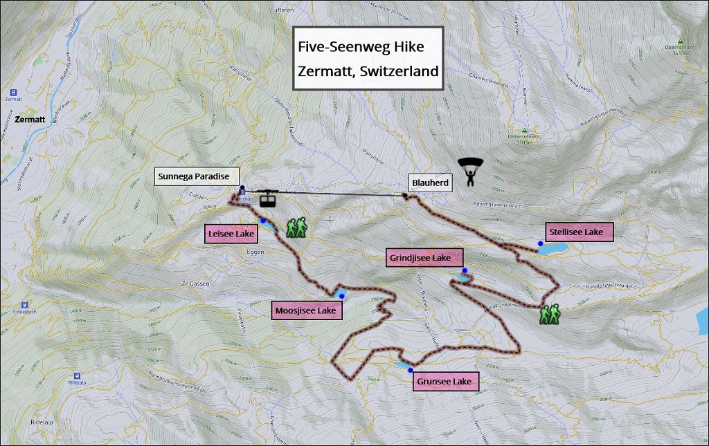
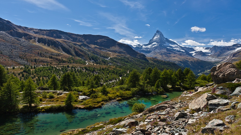
5-Seenweg Hike, Zermatt
Duration: 2.3 hours
Distance: 5.7 miles
The 5-Seenweg (5-Lakes Walk) is considered one of the best hikes in the Zermatt Mountains, taking you past five incredible lakes, with the Matterhorn reflected in three. Each lake is special in its own way: Leisee is a popular swimming spot, Grunsee looks out across a rugged landscape, Grindjisee is home to rare flowers, Stellisee is a photographer’s dream, and Moosjisee has a beautiful blue, milky hue.
Gornergrat Hike, Zermatt
Duration: 4-5 hours
Distance: 7.5 miles
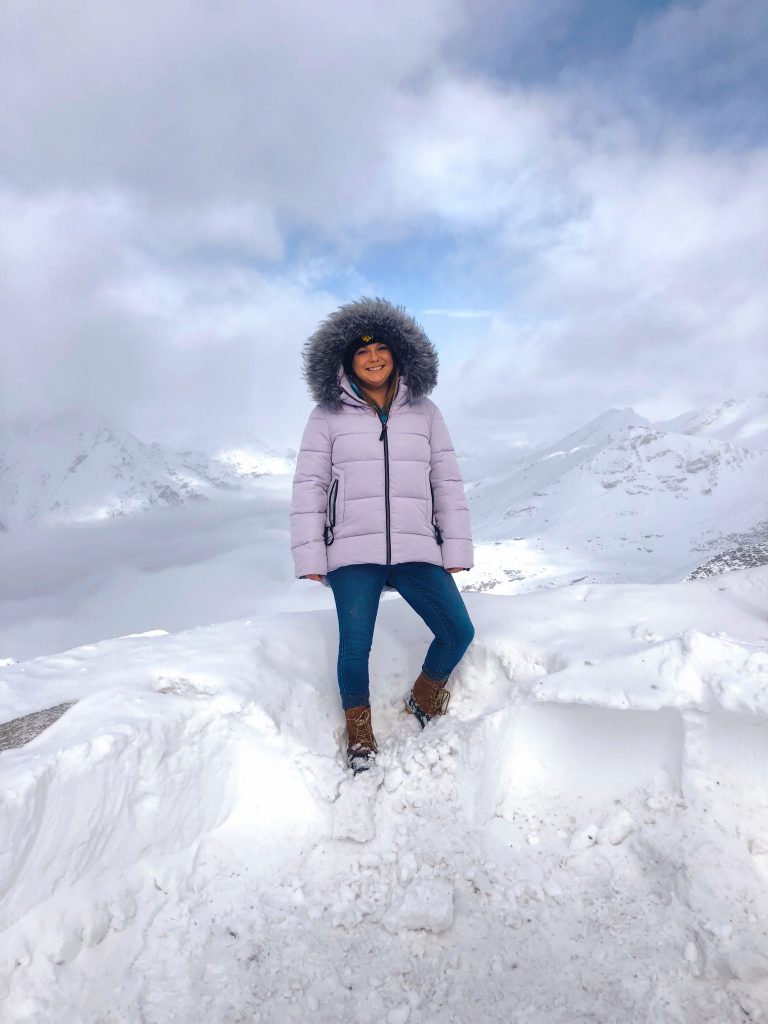
From the village of Zermatt, you can take the Matterhorn train up the mountains to the Gornergrat (or a few stops beforehand) where there are many opportunities for hiking! Be sure to bring your snow-proof boots and a thick jacket as there is snow 365 days a year. Whether you decide to hike up the Gornergrat or take the train up and begin hiking down, you will be surrounded by stunning mountains (including the Matterhorn) and landscapes!
Lauterbrunnen Valley
Duration: Varies
Distance: 4 – 12 miles (depending on the route)
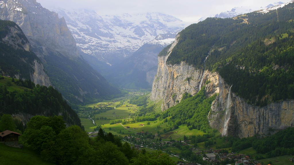
Lauterbrunnen Valley is one of the most impressive trough valleys in the Swiss Alps, situated between mountain peaks and massive rock walls. This area, known as one of the largest conservation areas in all of Switzerland, and its isolation makes this a perfect area to hike. The valley boasts 72 waterfalls, with Stabbauch plunging 300 meters (984 feet), and has such vibrant meadows that make the scenery portrait-like. This vast landscape can be efficiently covered by starting in the town of Lauterbrunnen, continuing to Grutschalp, and then off to Murren and Gimmelwald. In order to cover ground efficiently while taking in the surrounding environment, you may take the pied forest trail, which is a 90-minute ascension. If this is too difficult, you may opt for the tram to Grutshalp having an elevation of almost 5,000 feet. Here, you may continue through the forest, walking along the peaceful streams, until you find Staubbach Falls. As you continue on your route to Murren, you will see the Winteregg farm with fresh and savory dairy products. Eventually, you will begin to descend to the charming Gimmelwald Village (population 130!), looking out at Lauterbrunnen Valley. Here you may take the tram down to Stechelberg Village and walk about 20 minutes to Trummelbach to finish your hike.
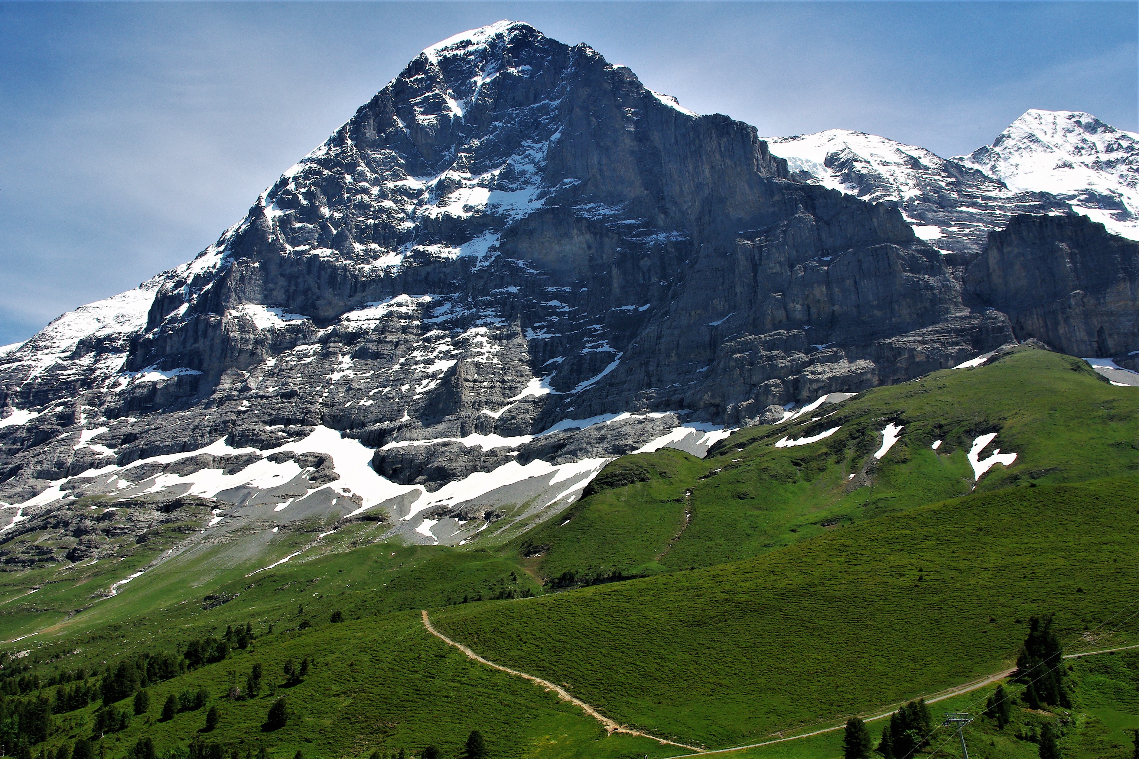
Eiger Trail (Beginning at the look-out point above Eigergletscher Station)
Duration: 2 hours
Distance: 4 miles
Located in the Grindelwald and Interlaken area, the Eiger Trail takes you to the base of one of Europe’s most well-known mountains: Eiger. With a limestone buttress jutting from the Munch, the Eiger is one of the most iconic images for all mountaineers. Along the route, you pass through high alpine pastures, lake landscapes of Grindelwald, and arrive at the intimidating north wall of Eiger.
The well-posted trail runs mostly downhill and the white ski slopes give way to lush pastures carpeted with Alpine flowers up to Alpiglen Station.
The pastures of Grindelwald are incredibly intriguing where human settlements have worked to exist with a foreboding environment. The view of green pastures complimented with the sounds of reverberating cow bells is heavily contrasted by a sinister looking rock face where mountaineers attempt its summit. At the trail’s midway point, there is a moving memorial to those have perished in their attempts to summit.
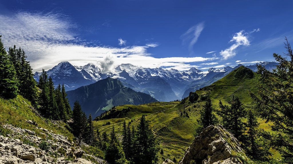
North Face Trail
Duration: 2.5 hours
Distance: 4 miles
With amazing views of three mountains (Elger, Mönch, and Jungfrau) we consider the North Face Trail to be a fun, picturesque hike for all ages, with a moderate level of difficulty. After a towering (10,000 foot!) cable car ride to the top of Schilthorn (and a hearty breakfast at the revolving restaurant), you make your way above the tree line with cows and cow herders aplenty along the way. As you will descend further, you will see various Alpine farms where the properties welcome visitors to see their cheese-making techniques. You will end up in the flowery meadow of the idyllic village of Grimmelwald.
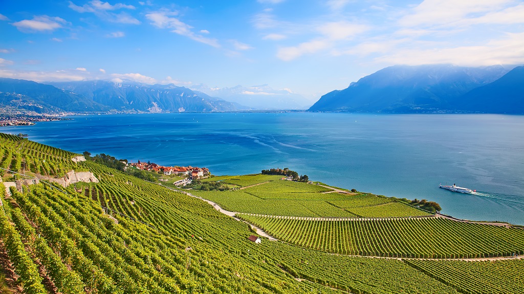
Lavaux Vineyard Terraces Trails
Duration: Varies
Distance: Varies
A UNESCO World Heritage Site, Lavaux Vineyard Terraces stretch 18 miles along the shores of Lake Geneva from the Chateau de Chillon to Lausanne. Extending between Lausanne and Montreux, Lavaux vineyards hug Lac Leman for about 30km. Getting here is an easy 10-minute hop on the train from the city center to the village of Cully. The history of these fertile hillsides goes back hundreds of years to the 12th century when the area’s Cistercian monks built stone called terraces into the soil. Nowadays, 400 km of those walls remain, lining as many as 40 levels of terraces that are some of the steepest in the world. About 250 different winemakers produce their crisp wines from this terrain: because of the narrow plots, using modern machinery is challenging here – which means much of the planting and harvesting is still done the old-fashioned way, mostly by hand.
There are 23 hiking paths to choose from, some close to the lake, though we particularly like the high panoramic trails reaching picturesque villages such as Saint-Saphorin and Dézaley. These medieval towns feature narrow alleys and winegrowers’ houses dating from the 16th to 19th-centuries. here you may visit pubs and cellars, sampling some of the region’s classic wines. The wines produced here are very light – pleasant to drink with food or on their own. Take a seat on the terrace of the Domaine du Burgnon for a bite and stay the night in the historical, red-roofed building. Hop easily between vineyards on the charming Train de Vignes – and on the way back, kick back as a ferry gently transports you from the town of Vevey to Lausanne.
